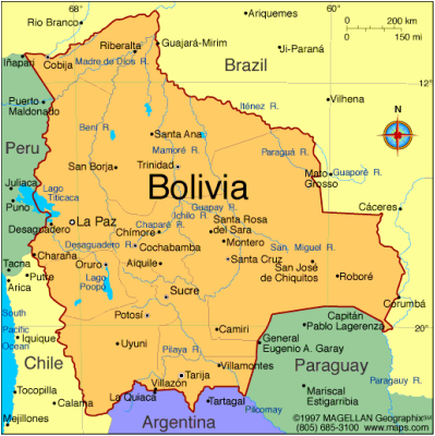
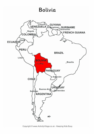
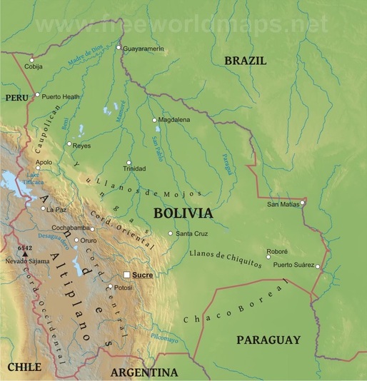
Where is Bolivia?
Landlocked Bolivia is located in western central South America.
- Northern and Eastern border: Brazil
- Southern borders: Paraguay and Argentina
- Western borders: Chile and Peru
|
|
Major Cities in Bolivia
- Santa Cruz de la Sierra - Largest and fastest growing city in Bolivia
- El Alto
- La Paz - Sometimes referred to as the administrative (or de facto) capital; houses the executive and legislative branches of the Bolivian government
- Cochabamba - Considered to have the best climate in Bolivia
- Sucre - Official capital of Bolivia; houses the judicial branch of the Bolivian government
- Oruro
Main Features of Bolivian Physical Geography
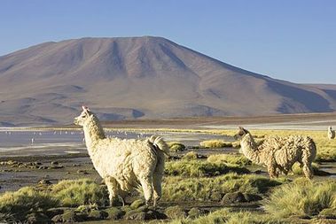
- The Altiplano in the West
- Second largest mountain plateau in the world
- Hosts cities like La Paz, El Alto, Oruro, and Cuzco
- Its height averages 12,300 feet
- Covers 12% of Bolivia's land area - has 35% of its population
- Lake Titicaca - World's highest commercially navigable lake
- Lies at the Bolivia-Peru border
- South America's second largest lake
- Surface area of 3,232 square miles (about the size of Puerto Rico)
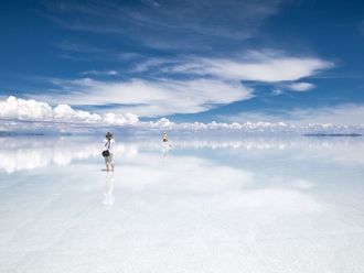
- Salar de Uyuni - Largest salt flat
- Few crops are grown here
- 4,086 square miles (about the size of Hawaiian islands)
- Approximately 12,000 feet above sea level
- Lake Titicaca - World's highest commercially navigable lake
|
|
|
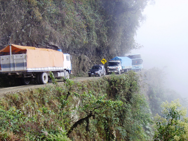
- Yungas ("warm valleys")
- A stretch of forest along the eastern slope of the Andes Mountains from Peru, Bolivia, and Argentina
- In Bolivia, it lies mostly in the south.
- Bears the most dangerous road in the world, called the "camino de la muerte," or Highway of Death.
- A stretch of forest along the eastern slope of the Andes Mountains from Peru, Bolivia, and Argentina
- Eastern lowlands
- Includes all of Bolivia north and east of the Andes Mountains
- Covers two-thirds of the country's national territory - sparsely populated
- Differences in topography and climate divide the lowlands into three areas (northern, central, and southeastern)
Climate
- The Altiplanos
- Desert-Polar climate with strong and cold winds
- The average temperature ranges from 59 to 68°F. At night, temperatures descend drastically to slightly above 32°F, while during the day, the weather is dry and sunny.
- The coldest temperatures occur in the southwestern portion of the Altiplano during the months of June and July.
- Yungas
- Temperate climate
- The humid northeastern winds are pushed to the mountains, making this region very humid and rainy.
- Temperatures are cooler at higher elevations. Snow occurs at altitudes of 2000 meters (~1.25 miles)
- Eastern lowlands
- Northern
- Consists of rainforests
- Consists of rainforests
- Central
- Has gently rolling hills and a drier climate than the north
- Has gently rolling hills and a drier climate than the north
- Southeastern
- Hot and semi-arid
- Receives virtually no rain for nine months out of the year, then becomes flooded for three months of heavy rain
- Hot and semi-arid
- Northern
